Send via SMS

Monday, July 25, 2005

More Hayduke Trail Photos

Some more images from Mike's trip on the Hayduke Trail. Enjoy!

hayduke trail
Looking down on Escalante River and Stevens Arch

hayduke trail
Bryce Canyon NP

hayduke trail
Fairyland, Bryce Canyon NP

hayduke trail
Cheat Grass Misery

hayduke trail
Shadow cast by Henry Mountains Over Burr Desert

hayduke trail
Aldo with Ruffwear Pack

hayduke trail
view of Waterpocket Fold and Henry Mountains
from Red Slide, Capitol Reef NP


hayduke trail
Cairns by the Purple Hills

hayduke trail
Incoming Storm, Kaibab Plateau, AZ

hayduke trail
(l-r)Ray, Chuck, Allison, and Ben Googing
Around in Paria River


hayduke trail
Looking Down North Kaibab Trail, Grand Canyon

hayduke trail
Ray with Surviving Boat on Escalante River by Stevens Arch

hayduke trail
Getting the Boats Ready, Escalante River

Monday, July 18, 2005

Hayduke Trail Photogallery

hayduke trail
Barrel Cactus Bloom, Grand Canyon NP

hayduke trail
Ben and Allison in Round Valley Draw

hayduke trail
Claret Cup Bloom, Waterpocket Fold, Capitol Reef NP

hayduke trail
Getting the Pack Ready at Middle Moody Cache Site

hayduke trail
Camp in the Henry Mtns,
Which Are Casting Their Shadow on the Burr Desert


hayduke trail
Ray Deep in Buckskin Gulch

hayduke trail
Ribbon Falls, Grand Canyon NP

hayduke trail
Small Slot Canyon Off the Paria River

hayduke trail
Surprise Valley Storm, Grand Canyon NP


hayduke trail
Jolley Gulch Waterfall, Zion NP


hayduke trail
Looking Down the Colorado River from
Kanab Creek at Sunrise, Grand Canyon NP

Tuesday, July 12, 2005

Feels Like Going Home

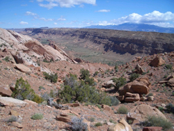
I’m writing this from the comfort of my own house, having finished hiking the Hayduke Trail after a completely enjoyable 75-day adventure. While circumstances prevented me from hiking the entire length of the HT, I still managed to walk over 600 miles and see and experience some incredible parts of the public lands of the Colorado Plateau, from Arches National Park to the Weeping Wall at Zion National Park.

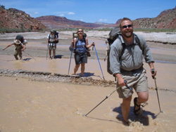
Ray, Dave, and I left the Grand Canyon after passing Jump-up Canyon, still deep in Kanab Creek Canyon, albeit a dry section (much to our concern). A tip from a backcountry ranger led us to a 500-gallon plunge pool, located in a small, narrow side canyon. The pool provided us with one of the most bizarre sounds of the trek and helped ensure enough water, but that later became irrelevant as the flow returned to the creek bottom by the time we got up towards Hack Canyon, our exit. The last night “under the rim” was spent under an overhang after a dark bank of clouds rolled in as we ate dinner; bats kept our “cave” delightfully clear of all the biting insects that harassed us along the way. We hiked the entire length of Hack Canyon the next day; after finding a dead bird and warning signs on the one spring in the canyon that we had hoped to get some water from, we decided to head toward the main road that marks the end of the section a day early, knowing that we’d encounter motorists passing by frequently enough to be able to use them as a last resort (with the hopes that some will have a little water to spare). Fortunately, Glenn Purpura arrived as scheduled to resupply us, meeting us out on the vast Arizona Strip with a truck full of food and water, cold beer and no bikes! Glenn came to the same conclusion that Ray and I had: riding bikes on sandy double tracks in hundred-degree heat would be less than pleasant, and, as seeing the latest information still indicated too much water in the Barracks, or East Fork of the Virgin River, for us to safely attempt a passage, he assumed he’d be bringing us around the river to Zion, which is exactly what he did.

hayduke trail
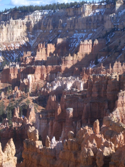
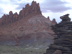
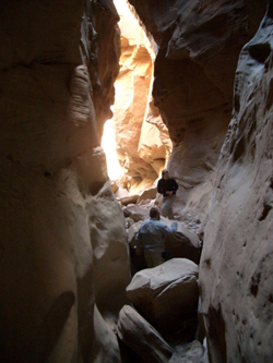
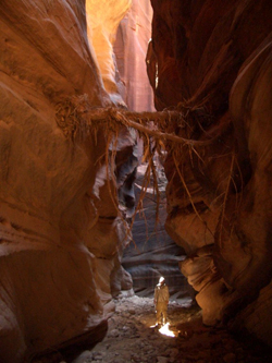
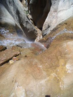
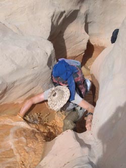
Exploring Muddy Rock

Four of us climbed up the East Rim Trail from the East Entrance of Zion National Park up onto Cable Mountain for one last night under the stars before our adventure came to its close. Hiking up was surprisingly easy with our near empty packs and light water loads, the vertical seemed negligible, at least relative to what I had already encountered in places like the Grand Canyon and Dark Canyon. Hiking through the recently burned forest was fascinating, with new growth sprouting everywhere. Getting out to the edge of Cable Mountain was a jaw-dropping experience to say the least; I finally found an exposure on the trek that was beyond my margin of comfort—the sheer 2000-foot drop to the floor of Zion Canyon was more than I could bear to get near.

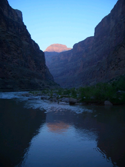
On the morning of the summer solstice, on the 75th day of an awesome and unforgettable adventure, accompanied by Ray (on his 52nd day out), Dave (on his 10th day), and Glenn (3rd day!), I hiked down the couple thousand feet from the rim to the floor of Zion Canyon to the end of the Hayduke Trail.

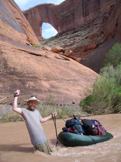
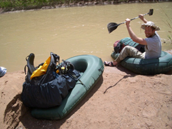
Driving home was a drag; being confined to sitting in a vehicle for six hours was a big change, but this time my adjustment back to the man-made world will be easier as I got to come home this time to the laid back small town of Moab instead of an impatient overgrown suburb like Salt Lake City (which I called home during my two prior multi-month treks). I got to spend a couple days unwinding behind the oars of my little whitewater raft on the still high waters of the Colorado River, now I get to finish moving into the house we bought just before the adventure began!

I greatly enjoyed this adventure, in part because of the solo time I had out, and in part because of the company I had, particularly Ray and his refreshing perspective on our crazy world.

Here’s some closing thoughts about what was great and not-so-great about the adventure, from both Ray and I:

Best Scenery
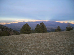
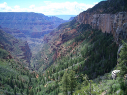
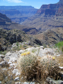
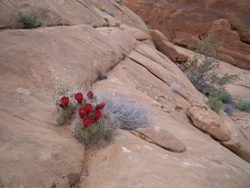
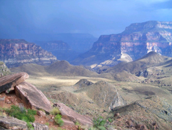
anywhere we went through with the sheer Navajo sandstone walls of the White Cliffs. An especially good view was from the top of No Man’s Mesa looking up Park Wash towards Bryce Canyon NP. (Ray) There’s two places that immediately come to mind, the view from the south summit of Mt. Ellen in the Henry Mountains overlooking the Waterpocket Fold, the Aquarius Plateau, the Dirty Devil drainage, the San Rafael Swell and so much more, and the view from the top of the butte that Ray and I hiked out onto by Saddle Mountain overlooking House Rock Valley and Marble Canyon on one side, and the Nankoweap drainage and the Grand Canyon on the other.

Biggest Surprise— crossing the Kaibab Plateau. 
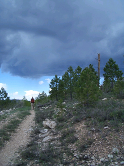
I’d expected the Kaibab Forest to be boring miles that had to be cranked out between amazing slots and the Grand Canyon. However, it was a beautiful, cool, calm place to walk with a sense of order after being in such wild rock formations. The scenery still changed daily as we gained elevation, from pj’s, to ponderosa, to mixed conifer and aspens. The nightly serenade of coyotes was a special bonus. Seeing the amount, color, and velocity of the water in Dark Canyon. Ron and I were still high on the trail when we first saw the creek, normally a fairly docile flow. The immediate thought was that we couldn’t cross, and yet we didn’t really have enough food to get around any other way. I was also surprised at how much I enjoyed my solo time and at how many people ultimately joined me on this “solo” trek!

Worst Experienceany time we tried to get information from government agencies concerning backcountry travel. The staff at the BLM, Forest Service, and National Park Visitor Centers haven’t been on any of the trails they’re giving information for. Every time we sought a report on trail conditions we were told it was undoable, which is apparently the standard answer rangers are told to recite to save the lowest common denominator of tourists from themselves. The nastiest thing I encountered on the HT was the odor and conditions above the Supai Tunnel, on the North Kaibab trail in Grand Canyon National Park. The volume of mule waste left a putrid smell in the air while the ground was slick with urine or covered in “droppings.”

Campsites
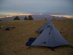
Of all the amazing places I’ve slept over the last few months, from scenery straight out of a fantasy world to views too big to comprehend, and the excitement of sleeping on the edge of a 1500-foot cliff, my best camp of the trip goes to one in Coyote Gulch for its spatial qualities. The camp was in a rincon with 300-foot high redrock walls completely encircling a tower in the middle and us. The worst campsite we had was determined by our unwillingness to sleep in a narrow river corridor in case of flash floods. We pushed through the scenic spots of lower Hackberry Canyon and camped in a dirt trailhead parking lot with the remnants of cattle grazing on the ground and powerlines humming overhead. My favorite camp is one where you can hear water running; trickles from a spring, or the roar of a rapid, so there were many in the last couple of months. My least favorite is when you can hear vehicle travel; fortunately these were infrequent.
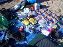
Gear—
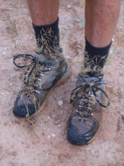
the function and versatility (along with some pride) makes my homemade tent/fly my best piece of gear. Originally I’d designed it as a bombproof winter shelter that utilized my trekking/ski poles as the structure to save weight. This was its first long term test and it held up great in thunderstorms, added needed warmth on chilly nights and, best of all, I figured out I could turn it upside down and rig it as a hammock in good weather and even use it as a poncho that covers both hiker and pack in the rain. By the way, any tent companies looking for R&D people, I need a job! My gear held up pretty well with the exception of a bunch of zippers, which all failed; my tent screen body (which does have well over 100 nights out), my convertible pants legs, one on my pack, a storage bag. The Miox water purifier deserves mention; it’s soooooo easy!


I owe a huge thanks to the many great companies that helped not only make this adventure a success, but that kept me comfortable, healthy, hiking and happy;
·Duofold (their Varitherm layering system rocks!)
·Alpine Aire (tasty freeze dried foods, fruit and wild rice snacks.)
·Ultima Replenisher (sports drink with no sugar, so much better than the big seller)
·Clif Bars
·Vasque (hiking boots that actually survived the Hayduke Trail)
·Thorlo (hiking socks, happy feet)
·Kelty (tent and sleeping bags)
·Red Ledge (rain/wind shells)
·Leki (trekking poles)
·Adventure Medical Kits
·Osprey Backpacks
·Brunton (compass, binoculars)
·Cascade Designs (Miox water purifier, Therma-Rest sleeping pad/chair kit, snowshoes)
·Exofficio clothing (comfy!)
·Gerber (multi-tool)
·Chaco sandals
·Smith Optics
·ACR Electronics (Personal Locator Beacon)
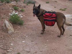
·Ruff Wear (canine gear)
·Reliance Products (water jugs, cache buckets)

I also owe a huge debt of gratitude to my wonderful wife Collette, who has been incredibly helpful and supportive as I have strived to showcase the beauty of these wonderful natural areas and the politics that put these unique places at risk.

I encourage people to stand up to the corporate thugs who are bullying their way into destroying what rightfully belongs to all of us, by joining up with the Southern Utah Wilderness Alliance, Red Rock Forests, or any other group dedicated to the protection of the land that makes the Hayduke Trail so special!
Get involved before it’s too late. Please.

Keep it Wild,

Mike Coronella

The Hayduke Trail Guide is available from the University of Utah Press at: www.UofUpress.com

Wednesday, July 06, 2005

Roaring and Thundering

Day 66—Once again we’ve experienced and seen quite a bit since the last time I wrote. I’ll start with leaving Cremation Creek. We had another beautiful night, interrupted briefly by the only two hikers we saw on the South Rim side. They told us about a pictograph panel near our camp which I managed to find before we hoisted our packs for the north side of the river.

Things quickly changed for us. It got cloudy and we went from a small trail to what seemed like a highway, complete with rest areas and garbage along the side of the trail. We were on the South Kaibab Trail, one of the major rim-to-river routes. We easily descended the couple thousand feet to the river, which we crested via the “black bridge,” which along with its nearby partner, the “white bridge,” are the only crossings over the Colorado River for at least 100 miles in either direction. There were also people on the trail for a change; backpackers whose packs were twice the size of ours (even though we’re out for a months and they’re out for a couple of days), day hikers in a hurry to get to the river and back to the rim, and weary-looking mule riders, including a sadistic kid who thought he needed to whip his mount three times for every step.

Up next was Phantom Ranch, where Mitch and I were treated so well during a brief layover on our 101-day trek in 2000. Ray and I got more of the same incredible hospitality. We found Rutha, one of the veteran “ranchers” and she quickly got the ball rolling with offers of food and drink, which we eagerly accepted and devoured. We went back to the bunk house for an afternoon’s rest and a cold beer when it started raining. We ended up hanging out all afternoon, waiting for the rain to end so we could hoof six and a half more miles to our planned camp. No dice—the ranchers talked us into staying for dinner and the night—not exactly a hard sell, but it set us up for a 14-plus mile day with a climb of almost 6,000 feet. It was well worth it! I even traded my dead camera battery for a freshly charged one —I can actually take pictures of the Grand Canyon now. (Thanks, Bridgette!)

We left Phantom at 5am and started climbing. Ribbon Falls, an unusual travertine formation, came along after two hours. Cottonwood camp, where we originally planned to be the night before, came a short while later. That’s when the serious uphill began, but it was cool out, easing the strain of the ascent. What didn’t help was reaching the Supai Tunnel; the end of the road for mule trips (a damaged trail prevents mules from continuing to Roaring Spring), and the beginning of a vile, slippery and literally choking session through what amounts to a barnyard outhouse. It’s amazing that the park not only allows hikers to experience such putrid conditions, but it virtually forces it on anyone who wants to climb to the North Rim (or off of it). When I asked the lady at the mule ride counter if they’ve considered “diapers” for mules, I got a very rude reply about how hikers should carry diapers and that we could just “deal with it.”

Anyway, we rimmed out in six hours, tired and hungry. We found our supplies for Section 13 of the Hayduke and Dane Lee, who has joined us for this section, as we walked to the lodge for a burger.

We tried to get an update on conditions in Tapeats Creek at the backcountry office to see if the water was yet low enough to follow along and cross, but the usual information ranger had the day off, leaving us with dated, and therefore, useless information. Oh well, we drove to the Bill Hall trailhead at Monument Point instead. The day after we climbed to the rim from the river, we hiked most of the way back down, this time with freshly loaded packs and already fatigued legs. Afternoon thunderstorms kept us entertained from the shelter of an overhanging rock—the thunder and lightning seemed to be non-stop. A break offered the opportunity to continue, so we took advantage and left the Esplanade for another rock shelter, above Thunder River, on Surprise Valley, where I am now—on the very first full “day off” that we’ve had. No need to hoist the packs for a change. Ahhhh….

Day 67—Back down to the river again. After a day off and a second night at the same camp, we slowly made our way down, stopping at Deer Creek Spring, which like Thunder River, is screaming out of the rock at a higher flow than I’ve seen before. The narrows provided shade and cool on the first day we’ve had that’s gotten into the nineties.

The day off had Ray and I resting (except for the mandatory visit to the always impressive Thunder River, where an enormous volume of water erupts from the wall of the canyon, sending a frothing cascade down the steep drainage that helps feed Tapeats Creek), while Dave, with fresh legs, went out and checked out some of the upper and lower Tapeats, reporting back that while he managed to cross the creek, it was difficult and we were wise to have decided on an alternate route.

Today, we’re two days ahead of our original schedule, but back on the Hayduke Trail with as little as eight days left of the journey! In fact, by the time this is posted, we could be done, something I have deeply mixed feelings about. On the one hand, I want to be home with my wife of less than one year and I’d like to work on the home we bought just before I began this adventure and I’d like to get back to training Aldo to be a certified search dog. On the other hand, I need to paint the house and go back to the crazy tourist world of Moab, back in hurry mode, hearing traffic and lights drowning out the stars. I like waking with a different view every morning. I’ll miss watching the river go by during our usual mid-day siesta, listening to rapids or a canyon wren. Peace is obtainable out here, I can only try to obtain such a stress-free existence upon my exit from the world that is constantly being exploited with little thought for the future.

Day 68—Finally!! We’re getting to Grand Canyon temperatures; 99 degrees in the shade—after dinner! We made it to Kanab Creek, the drainage that we’ll exit the Grand Canyon through. We didn’t hike the nasty, boulder-hopping route though—we hitched a ride on a boat (and even got wet in Fishtail Rapids). I can’t give them credit for the ride—I don’t want them to have any trouble on our behalf; even though a backcountry ranger suggested avoiding the tedious eight mile boulder hop, it’s not allowed for boaters to give hikers a ride downriver—only across is legit.

While sitting in the shade, we watched the river flow basically double, part of the most unnatural daily tide from the Glen Canyon Dam. In between swim breaks, I whittled a spoon from a piece of driftwood to replace the broken plastic spoon that I’ve used close to 300 times while route finding the for the Hayduke Trail. I was also kept entertained by a small group of collared lizards; two males and two females doing what males and females do: feeding, flirting and fighting. There was all kinds of colorful posturing; the males would puff themselves up, do little push-ups while turning necks and bellies bright blue. The larger one would run the smaller male off whenever they got close. The females were happy to walk around with heads turned to orange.

Day 69—What a fabulous day. We woke at dawn on the river—the last time I’ll see the once mighty Colorado River until I’m home in Moab. We quickly packed camp and headed up Kanab Creek. Like the rest of the drainages on this journey, Kanab Creek is flowing, but this time the water is warm, offering countless opportunities to take a dip on another hot day. After about three miles we dropped our packs and took a little side trip to one of my favorite places in the Grand Canyon: Whispering Spring, which has a travertine chute about 18 inches wide and several hundred feet tall, with a stream of water cascading down the chute into a 15 foot deep plunge pool, half of which is in a cave. There we had our first swim of the day. We even saw a couple of bighorn sheep with a baby on our way out. After a mid-day siesta involving a cave for naps, and of course, a swimming hole, we continued up the creek with our feet in the water most of the time.

We’ve settled for the night—our last in the Grand Canyon National Park—at the most wonderful and unlikely formation, Showerbath Spring. The spring juts out over the creek about a dozen feet up. The entire thing is covered with ivy and ferns, but surrounded by prickly pear cactus. The best part, though, is that the whole protrusion is porous limestone, and acts like a massive showerhead with water streaming and trickling down everywhere. A cool shower and a water source all at once—what more could we ask for in a hot desert canyon?

This post is getting long, so I’ll end it today, our last in the Grand Canyon. With only about a week left of this phenomenal adventure, the next post will come from home.

Please help keep it wild!
From one very happy camper,
Mike Coronella