Tuesday, June 21, 2005

Meandering Through Red Cliffs

Editor’s Note: This latest dispatch was mailed by mule at the bottom of the Grand Cayon.

Day 60
Greetings from the start of the 12th section of the Hayduke Trail. We’ve now been under the rim of this massive network of colorful drainages for a week, and while we’ve encountered a number of boaters, we have yet to see a single hiker! And this place is paradise! That’s not to say that it’s easy going—it’s not. But since we left the Little Colorado, it’s all been on trails, so route finding at least is easier.

Five us of left Paradise Creek a few days ago, and we followed the Beamer Trail to its end at Tanner Canyon, which began the “Escalante Route” that we’d finished at Hance Rapid. The walk was easy for four of us. We went to Cardenas Camp, while Ray chose to burn some energy and hike up Tanner Trail to the rim. While Ray sweated his way to a successful mission, the rest of us sat in the shade of willow or tamarisk trees with our feet in the chilly water of the Colorado River.

The way to Hance brought us high above the river on a well worn trail. The view was nothing short of spectacular; we were able to look upstream into the wide part of the gorge that we had passed through, the Grand Canyon “supergroups.” An enormous geologic unconformity dominates the erosive character, as well as a view into the upper Granite Gorge by Hance rapid, where the canyon narrows greatly, home to some of the river’s biggest rapids.

The rest of the Escalante route was not so friendly, matching neither my memory of our passage in 2000, nor that of the description in our guide. There were three separate times the trail came down to the river, only to climb well above the water again. The one bright spot was when the route passed through the narrows of Seventy-Five Mile Creek.

Ravens made their presence known again; we found out that they know how to open backpacks and zippers! Fortunately, these intelligent pests mostly found our garbage, but Ray once again lost part of dinner. Another critter has been conspicuously absent, but that’s been fine. We’ve only seen exactly half of one rattlesnake so far. The tail end of a small rattler was found lying across the middle of the trail.

The travel in the Grand Canyon has been tough, but the scenery is beyond what the imagination could fabricate. The scale is unbelievable. So far, the weather has been remarkably cooperative, the nights cool (in the 50’s), the heat in the shade hasn’t even cracked 90. It’s been so much more comfortable than the expected 20 degrees warmer, but Ray and I still lost the rest of our comrades to the Hance Trail, all opting to head to the rim. We’ll miss their companionship and conversation!

Grand View Trail, which leads from the rim to our brief home on Horseshoe Mesa, has been closed since February; a section of the trail in the Coconino layer slid into the abyss—as they say, this place is falling apart! We figured it’s been since February anyway, there’s no fresh sign of folks anywhere, and the last entry in the register in the Cave of the Domes was February. Ray and I spent a couple of hours exploring that cave, which is much larger than I would have guessed from my previous visit, and far more spectacular than I would have dreamed!

Of course, the ravens took advantage of our absence and tried to raid our packs again. All they got from my pack was some black pepper, which they must not like—I found the shaker 40 feet away.

Day 61
I’m sitting and looking at one gorgeous sunset; the Palisade Cliffs to the east are cherry red as they catch the last rays of the sun, which is sinking over the most fascinating horizon line one could ask for. I’m perched on the Tonto layer, almost 2,000 feet above the river, overlooking a fair amount of the Granite Gorge. The river is pale green as it snakes through the jagged brown, red, pink and white ridges that are part of the 1.8 billion year old schist. Grapevine Creek rapids are below us, while its namesake canyon climbs behind. Across the river are countless temples, mesas, buttes, points, promontories, etc that form the mess below the North Rim. Cape Royal is across from us, as it has been for three days now, being near the hub of the semi-circle that the river makes here.

As the sunset fades to dark, the thinnest of crescent moons is revealed just above the dwindling light. How lucky are we to witness such an amazing spectacle in such an amazing place?

We were talking about how river miles seem deceptive at times; because of a meander, a river might travel for a couple, or even several miles to move a quarter of a linear mile. Today, our nine miles got us all of two river miles! Oh yeah, we finally saw a comatose Grand Canyon pink rattler.

Day 62
Another day on the Tonto Trail, and it went quickly, at least our miles did. After another perfect night, with temps in the upper 50’s, and enough stars to practically see color on this moonless evening, we hoisted our now lightweight packs and moved on. We finally saw a couple of hikers out; they informed us that water was available in all the drainages we’d be passing, so our water load is minimal, and our food supply is dwindling.

We’re now having a siesta at Cremation Creek. Tomorrow, we’ll pass through Phantom Ranch, where I will post this letter myself. We’re having a grand time in the Grand Canyon!

Keep It Wild,
Mike Coronella

Monday, June 13, 2005

Into the Canyon

Day 54
I am writing from a completely different world than where I penned the last post. Instead of forest, snow and cold above 8,600’, we are now in a deep gorge, it’s hot, at about 3,500’.

On day 51, I split from Ray and post-holed way to the North Rim of the Grand Canyon in sometimes waist-deep snow; I finally found what the Forest Service was warning us about. I hitched a ride to the village and went straight to the post office to grab my camera’s battery charger. No dice—despite being express mailed, it didn’t make it, so I have got to be extremely selective in what I shoot.

I’ve got to interrupt myself here to report one of the more bizarre happenings of the journey: Ray put a small MRE on some hot rocks in the gorge here to heat up his “appetizer." A raven (or what I call the “majestic black desert eagle”) promptly flew away with it. By the time Ray tracked the thief down it had finished his treat!

OK back to the post –

I decided to inquire at the lodge if they had any rooms, knowing they’d probably be sold out, being Memorial Day weekend. They were, but the thought of a bed and shower was intriguing. I was in the restaurant having a lunch that was not Clif bars for a change, when Michael from the front desk found me and told me he had a room if I wanted it! For the first time in my life I decided to splurge—I got the room and dropped my pack there just as a nasty thunderstorm rolled through.

A shower, a quiet, warm(!) night, and a sink that doubled as a Laundromat—I was squeaky clean and happy. I decided to eat a good breakfast and then who do I run into? Ben and Allison! They were back for more of the Hayduke Trail. Ray showed up in the afternoon with tales of his own adventures bushwhacking through fallen trees and we found the newcomer, Greg Prosl, publisher of MountainZone.

We all headed out of the park for a very windy night of camping. Ben and Allison departed at dawn; their permit in the GC starts a day before ours does. Of course, nothing has gone smoothly for those two, this time the trailhead at point Imperial (our back-up access to the Nankowemp Trailhead) was closed for a search and rescue operation. They came back to camp to report the bad news and drove off greatly disappointed. In the meantime, Greg drove Ray and I back to the park where we readied our packs and supplies for 12 days of GC hiking. To lighten the load, I ditched my warm layers and my tent, whose zippers were foiling on the screen body, removing any usefulness in the hot dry gorge (I hope….!).

We headed out to Point Imperial to see if we could get at least to Saddle Mountain and found the SAR folks gone—it was a go! A condor soared overhead as we ate lunch, one of many I had seen since arriving the day before. The North Rim seems to have become a popular destination for these huge endangered birds. The three of us hoisted packs and headed through the eerie remains of the forest, burned a couple years ago in the massive Cape Royal fire, dealing again with countless downed trees.

We set ourselves up at 8,600 feet just outside the park boundary—giving us the biggest vertical descent in the park —virtually a mile straight down. Lo and behold, just as it was getting dark, into the camp walk Ben and Allison. They weren’t ready to give up the sections they most anticipated.

A very difficult and sometimes frightening walk brought us down to Nankoweap Creek, home of the canyon’s first wild fire of the year, a fire that burned much of the canyon bottom just a week or so ago.

The National Park considers the Nanko Trail to be the hardest in the park and we found out why (I’ve only ascended this monster before, which despite a heavy water load proved to be much easier than going down). The trail pinched off in places to a mere boot-width, with drops of several hundred feet that in turn lead to cliffs thousands of feet tall—talk about exposure! The five miles of ledge walking of the Supai layer finally gave way to a steep descent on a trail that was covered with just enough gravel to act like ball bearings; again a slip would lead to a life-ending freefall. We all made it down without incident and were treated to a night of warmth for a change—our last night up top was so cold and windy I was forced to erect a makeshift shelter out of my blue tarp to stay warm. At least the wind and storms brought a cold front, which might actually keep the temperatures in this huge stone oven below one hundred degrees.

Well, Ray’s appetizer was just returned to us: a raven deposited a load of turds onto Ben and Allison’s tent, showering their sleeping bags and Ben with a nasty surprise! I think those two need a break!

Day 56
We’re in deep, literally and figuratively. We’ve all reached the confluence of the Colorado River and the Little Colorado River, whose bright turquoise water makes such an amazing contrast to the guacamole green of the river we’ve followed for two days.

The canyon has been hot, not oppressively so, but hot enough to get us moving out of camp by 6 am. We’ve reaped the rewards of this year’s above average precipitation: thigh deep cheat grass, which is not only slippery and obscures the already faint game trails that we’re following, but it inundates clothes and shoes and socks with evil, difficult to remove spikes. The scenery is a little easier to take; the massive walls of Marble Canyon towering overhead, the layers easy to differentiate, all five of us— three are first timers in the gorge —can readily pick out the supai—host of Nankoweaps dazzling descent.

Besides moving early, we’ve also been ducking into the shade in the heat of the day, then walking on when the sun’s gone behind the giant wall. Yesterday’s retreat brought us a great surprise: lunch from a Western Rivers group who wanted to share our shade. Today’s lunch was courtesy of a Wilderness River’s group who ferried us across the river to the south side. At least it’ll keep my pants from falling down this week! (Actually I do eat pretty well; I owe a great thanks to Alpine Aire Foods and Clif bars for keeping me fueled up!)

This post is heading up the Tanner Trail with Ray, who needed a little extra exercise (like 20 miles with 4,000’ ascent and descent).

Keep it Wild,

Mike Coronella

Wednesday, June 08, 2005

Coyote Calls and Hummingbirds

Day 49
The last time I wrote we were at what should be our last camp in Utah for the better part of the month. Our last day in Utah was as spectacular as it gets. As we were thru-hiking not “day hiking” (and neither of us were willing to give up a $20 without getting change) we decided to forgo the $5 fee to enjoy Buckskin Gulch. The sandy wash almost immediately led to one of the more surreal places imaginable; red sandstone buttes of all sizes and shapes with strata lines going every which way. There were a million wildflowers to accent the scene; we even stumbled across what must have been a “midden” or ancient garbage heap containing thousands of pottery shards, some gray, some black, some red, some painted with classic southwest patterns, others were corrugated or ribbed. Broken stone tools and flakes of chert were mixed in the shards; keeping our eyes busy as we poked around to see who could make the most interesting discovery. Note: you can look, but the Antiquity Act prohibits removing any artifacts.

A little further down the wash, we entered a section of narrows in the red stone, something we didn’t expect until lower down, where we found the deepest slot canyon we had yet to visit.

We exited Buckskin Gulch, the fourth name for the same drainage we had taken all the way from Bryce, by way of Wire Pass and yet more narrows. A quick mile and a half south of the trailhead brought us to the AZ/UT border and the end of Section 9. Ray and I each extracted our cache buckets from the hillside; each intent with food and water—mine had even become home for a very astonished pack rat who sat stunned as I disassembled the rock walls I built to conceal my goods. (I thought this was quite a testament to the integrity of the reliance buckets and water jugs I use for caches—the homesteading pack rat hadn’t breached either.)

Ben and Allison spent the night with us at the AZ state line trailhead; they wanted to get their cache while driving through. They also treated us to a couple cold beers and some dreamt-about ice cream (the temperature got into the 90’s during the last couple of days). The following morning Ray and I headed up the 1,200 foot climb to the top of Buckskin Mountain with a fresh load of food and almost 25 pounds of water on each of our backs. Yesterday, our fourth 15+ mile day in a row brought us across AZ highway 89A, just east of Jacob Lake, to a beautiful ponderosa forest high in the Kaibab National Forest. We ditched our packs in the trees and walked the couple miles to the Visitor Center to see what we could find out about water and trail conditions and to treat ourselves to a meal at the inn. What we discovered has had a major impact on our plans: the road to the We left messages changing the meeting site; we hope it’ll work out—only time will tell…At least finding water should be easy!

We’ve now spent three nights in Arizona, all three of which have been punctuated by the mesmerizing sound of coyotes calling out to each other. That’s 3-for-3 in Arizona, 1-for-45 in Utah. What’s up with that?


hiking hayduke trail
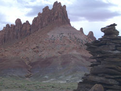
Cairns

Day 50
Today was our sixth day of 15+ miles; we’ve walked just about 100 miles in those days, the most in such a short period of time for both of us. Today, as promised, had us in the snow, just not nearly as much as there was made out to be. The snow's only in sheltered north faces and only on the very south end of the Kaibab plateau. More troublesome has been the fallen trees—literally hundreds of fallen fir, ponderosa and aspens have caused us to either detour around, climb over, or crawl under to keep going, sometimes creating our own paths through a blow-down tree by breaking branches with hands, poles or feet. The most fun is when there’s snow under them that we posthole in as we make way.

We’ve also encountered far more water than expected; all the “tanks” and wildfire “guzzlers” are full, and many drainages are overflowing their banks, making today’s 18 miles a mushy, wet-foot experience. The rain (accompanied by hours of thunder) played a role there as well. Once again, we get rained upon when it’s cold; something that would have been a lot easier to take on the 90 degree days we recently had. It does seem to have cleared up tonight, but now, at 7 pm, it’s already down to a mere 48 degrees where we’ve settled for the evening by “Sourdough Well”, a pretty little hollow in a mixed conifer forest with a gurgling brook coming down what’s supposed to be the trail—more cold, wet feet tomorrow apparently.

We’re poised for an easy day tomorrow. Ray is going to scout the Nankoweap Trailhead, then hike into the Imperial Point parking lot to hitch a ride to meet me and, I hope, the rest of the crew. I’m going to head into the park via the main gate where I’m going to then hitch a ride to the North Rim Village to pick up the charger for my camera, which my wife express-mailed, as my spare battery apparently never was ordered.

***

I thought I was going to be able to get the charger tomorrow, but being out here for so long now, I just found out that it's not only Sunday but that it is also Memorial Day weekend, forcing my little hiatus: the post office is closed Monday as well.

Today’s walk started in a perfect ponderosa forest close to the North Rim parkway, Highway 67. We quickly walked into one of the huge open meadows while paralleling the road where monster RV’s passed by with drivers oblivious to the fact that one could actually WALK to the Grand Canyon. Each grass covered meadow we passed through had a pond or two or three, some of which were obviously overflowing—the Kaibab plateau has very little in the way of drainages with water, usually. Water here generally percolates right into the limestone, filling underground reservoirs that feed springs like Roaring Springs, Crystal Spring, Thunder River and Showerbath Spring.

It was in one of these meadows —Tater Valley— narrow, three miles or so long—that the rain hit. Just after donning my rain gear, my eyes were delighted by two birds that flew in opposite directions in front of me: a bright yellow Tanager, with its green and red wings and head, and a vivid mountain bluebird. Later, just prior to dropping our packs for the day, we intruded on two more of the many birds that play on the massive Colorado plateau: a pair of mallard ducks. Birds are everywhere out here, even as I write this I’m listening to a couple separate Hermit thrushes , a hummingbird racing around, some little grey birds twittering, and a jay (pinion?) yammering. All the while, most people most people are listening to some psychobabble on their idiot box. Ah!!!!

For a change, I’m putting this post in the mail myself—tomorrow—from the North Rim of the Grand Canyon. It’ll probably be a week at least before I have the chance to send another; we’re leaving the snow for the blistering depths of the inner gorge.

Until then, from the REAL world, keep it wild!
Mike Coronella

Wednesday, June 01, 2005

In Defense of Nature

The Hayduke gang is back to four; my brother Chuck left us at Rainbow Point two days ago. Rainbow Point, elevation 9,115 feet, gave us all a taste of what I got to “play” in when in the Henry mountains weeks ago: ponderosa forests, enormous views, and trudging through the snow.

Yestereday, we left the land of the Pink Cliffs for the White Cliffs, two of the stairs that make up the “Grand Staircase” for which this huge national monument is named. Now instead of ponderosa and birch trees, we are back to sage and “PJs,” or pinyon-juniper forests. For the second time on this adventure, the higher elevations showed recent evidence of the unexpected: bear tracks, something I’m reluctant to report as local folks seem to despise predators, but it certainly gets the heart beating when you contemplate sharing space with hunters as large as we are.


hiking hayduke trail
Ray, Chuck, Allsion, and Ben in Bryce

There’s also been a lot of cat tracks and large deposits of cat poop, though a sighting still remains elusive. Then there are the coyotes, or rather the lack thereof. I’ve still only heard their chorus a single time, well over a month ago in the Canyonlands. We’ve seen some tracks, but that’s about it.

As we leave the White Cliffs behind us, we also seem to be walking away from water; both Bulrush (which we followed most of the day yesterday) and Lick Wash were flowing when we first encountered them, but both eventually dried up, the water disappearing into the desert sand. Fortunately, we’ve got water caches hidden away to keep us going (though we’ve all carried extra from Riggs Spring in Bryce, as the cache we’ll reach tonight was originally intended for my solo journey).

Now for a little self-critique: part of my mission on this expedition is to ground-truth the Hayduke Trail Guide. So far, there’s been a few problems, a few errors. The guide does a better job at describing the line Mitch drew on our quad maps on previous journeys than at describing what’s actually on the ground. I’ll be posting my notes and changes on the Hayduke Trail page of my website (www.deepdesert.com) after the adventure is completed. So, if you’re planning on trying out part or all of the Hayduke Trail, make sure you check that out!

Day 45
The Hayduke adventure is certainly living up to its name. First, my water cache was spitting distance from a beautiful unmarked spring. That was good, as the nearby spring on the map was dry. Ben and Allison left us at Hwy 89; Ben has a herniated disc in his back that simply made it too uncomfortable to continue. Not so good. (We still hope to see them at the Grand Canyon in a week). No gang, no more!

Ray and I continued down Upper Buckskin Gulch, a beautiful, seldom visited canyon that feeds the famous slot canyon lower down. The day was a hot one, easily in the upper 80s—good thing for all the water we are carrying. The canyons were virtually dry. It’s also showed us that it’s getting to be “siesta season,” time to hide in the shade for the hottest part of the day. At one point we apparently encroached near a nesting site of two unfamiliar large raptors; they were soaring and screeching as we passed.

hiking hayduke trail
Ray climbing in Bryce.

After a 15-mile day, we’ve camped near the Buckskin Gulch trailhead, still five miles up from the Narrows. A sign at the trailhead informed us that there is a $5 per person per day fee to merely WALK through this drainage, something that should have very little impact on the ground. At the same time, cattle grazing is permitted here—Utah’s only BLM Wilderness. To keep the five dollar (daily) fee in perspective, consider this: a cow and two calves may graze here (yes, this is what someone calls their “ranch”), trampling plants, introducing exotic and invasive species, degrading water sources, displacing wildlife while shitting and pissing all over (and you thought you’d get the smell of wildflowers) for a whopping $1.79 a month! That’s less than two cents a day per cow, while we’re asked to fork out 250 times as much. Does this seem unreasonable to anyone else? I’m feeling like I’m being asked to subsidize the single most destructive activity on public lands.

This is exactly the kind of awareness we hope to bring by following the Hayduke Trail. If you think this is as pathetic as I do, call your U.S. senator and bitch—maybe they’ll listen (but don’t count on it unless you can compete with the cattle industry’s campaign donations).

I’ve asked this before: What would Hayduke do? Would he pay?

To close, I’d like to share a few sentences from Ellen Meloy’s The Anthropology of Turquoise: Every nature girl and boy should be prepared to defend the places they love. Otherwise we have not earned them. When we march in from the starry nights and dazzling rivers, we must argue on their behalf, pressure politicians and other moronic invertebrates to wean themselves from their unsightly addiction to corporate blubber and for once act in favor of things that matter, like air to breathe, water to drink, and space to roam. We must…speak for the creatures that have no voice, staunch the lunatic hemorrhage of wild lands from the face of the planet.

Tomorrow: Arizona!

Keep it wild,
Mike Coronella