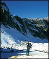
Nodding toward my overflowing bowl of pasta, Stefano smiles and says "finish it." I'm here in Italy to check out the hiking in the Val Camonica region and my companions, Julie and Dan, and I are just settling into the first course of a normal three-course lunch at the Rifugio Campo Vecchio. This small dormitory-style hotel is the start of a two-day loop hike through the Riserva Regionale delle Valli di S. Antonio, translation: Saint Anthony Valley's Regional Nature Sanctuary. Relatively unknown outside Italy, the Val Camonica area northeast of Milan offers spectacular and uncrowded alpine trekking terrain.
On the hike through the Riserva, the only warm-blooded units you will encounter have either feathers or four legs. Humans are scarce: for every 1,000 people heading for the Dolomites, one comes here to the Riserva. Yet, at the end of a long day, those who trek in this off the beaten path region will find friendly rifugios offering beds (with sheets) and hearty meals accompanied by three kinds of wine. Think about this more carefully: not only don't you have to carry a tent, or a stove, or even a sleeping bag, but someone feeds and imbibes you each night. Plus, route finding is never an issue. The trails are well marked with splashes of red and white paint and frequently have signage indicating distances in hiking hours.
This two-day loop hike is roughly 30km (18.75m) with moderate elevation gain and loss. Wildlife viewing opportunities include eagles and deer, while the mountain views —the Italian Alps—are enormous. The two days can be divided into practically equal mileage; both require about five hours of hiking with the night in between spent at the new Rifugio Torsoleto. (You need to reserve meals at this rifugio in advance and although it supplies bedding, it's best to bring your own sheet sleeping sack.) You can also opt to do this hike in one long push, returning back to the Rifugio Campo Vecchio where manager Dario Albertoni will greet you with an aperitif followed by a calorie-recharging, multi-course meal.
Like most hiking in northern Italy, the best time to go is between June and September, with the exception of August when every Italian is on holiday. Dario offers a three-night package (two nights at the Campo Vecchio and one night at Torsoleto) plus round-trip four-wheeled drive transportation from the town of Corteno Golgi up the two-kilometer road leading to the Campo Vecchio for $135-$150, depending on the exchange rate. And this rate includes your three daily meals, which are huge portions. You can email Dario at dariococco@lombardiacom.it.
(
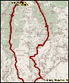
How to get to the Riserva)
Or, if you prefer to arrange your trip through a travel company, check with Mountain Link in Richmond, CA (www.mountain-link.com, ph: 1-800-408-8949). In the fall of 2001, they will begin offering trips to this area, led by Dan Windham (the same Dan mentioned in this article). Dan's not only fluent in Italian, he's an accomplished climbing guide who lives in Menaggio on Lake Como and knows Northern Italy well. Contact Mountain Link if you'd like to arrange a private trip with Dan.
From the town of Cortena Golgi, it's less than a hour's bus ride to Temù and the start of the classic high-alpine route known as the Alta Via Adamello, a 50km/31m trek that slices through the Italian Alpine range in the Parco dell' Adamello. Seven rifugios, open mid-June to mid-Sept, punctuate the route at regular intervals. Reservations are recommended during the popular summer months, but you will not be turned away (though you may be sleeping underneath the kitchen table). You need at least five days to properly hike this route and with elevations topping 10,000 feet, even a daypack can weigh you down (translation: if you're in shape it won't hurt so much). Plan on seven days if you want to do side trips—there are various peaks to climb along the way, including Mount Adamello, 3539m/11,607ft, the highest peak in the Parco dell' Adamello.
Although the Alta Via Adamello can be hiked in either direction, starting in Temù ( hiking north to south) offers the advantage of easily bailing if you decide this is not the trip you had expected. However, those who push on will find that this high route traverses not only country carved by glaciers but shaped by an exhausting three-year war between the Austrians and Italians during World War I. Known as La Guerra Blanca, or The White War, the remains of battle still line the trail, including a large cannon-like gun.
(
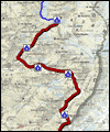
How to get to/from the Alta Via Adamello)
Again, if you don't want to deal with independent travel, call Mountain Link (www.mountain-link.com, ph: 1-800-408-8949).
If you find yourself in the Val Camonica area during winter, perhaps even skiing at the Ponte di Legno-Tonale Ski Area, which boasts 27 lifts, consider taking a break for a couple laps of dog sledding. Armen Khatchikian, the only Italian to participate in the Iditarod three years in a row, operates the Italian Sled Dog School in Tonale, situated between the ski area and the village of Ponte di Legno. If you're from the lower 48, be the first on your block to mush, an activity normally available only to Alaskans.
The Italian Sled Dog School has laid out a groomed course for novice (and more experienced) mushers and I watch as my team, two frighteningly eager dogs, is fitted with harnesses and attached to the sled. When I learned I would be dog sledding, I knew the Iditarod was strenuous, but somehow this failed to infiltrate my vision of a mellow outing. Instead, my misinformed imagination has me sitting in a sled that's pulled around by dogs... passive stuff. As I mount my sled, my team strains at its harnesses and I'm told to keep my foot on the brake. That's interesting—dog sleds have brakes—and I soon find out why.
It's now time to shove off and to do so, I move my foot off the brake and onto the sled's runners which are fitted with rubber foot grip pads. Stefano, our Italian host, is piloting the sled right behind mine. Everything's going well as we start out across a level part of the course, however we are soon heading downhill and, picking up speed, I instinctively start to brake. From behind I hear Stefano yelling "Let them run, Sara, let them run." So I inch my foot off the brake and the sled quickly picks up more speed and I'm closing in on the dogs—we head into a turn and I fall off the sled.
My team keeps moving but more slowly and I run, catch the sled and jump on. The next part of the course is uphill and the dogs are straining. Again I hear Stefano, "Work with them, Sara, work with them." Translation: get off the sled and run alongside until you crest the hill.
I'm starting to sweat and beginning to see a pattern. Too much speed on the descent and too little on the ascents—I fall off three more times, barely staying on when we cross a stream. Stefano says I'm doing really well. Breathing hard, my shoulders aching from steering, we finally finish the loop and Stefano and I hand over our sleds to Julie and Dan. On the first downhill, Julie flies off the sled and belly flops.
Despite the learning curve bruises, we all enjoy the workout.
Val Camonica is open year-round, with hiking, climbing and mountain biking in the summer and skiing in the winter. So, if you come, pack your sense of adventure, a huge appetite and your Italian language skills and leave the English and the tent at home. After hiking the Italian way, the rifugio-less trail networks in the US National Parks and Forests will seem rather uncivilized.
—
Sara "The Musher" Machlin, MountainZone.com Staff